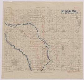
'Situation Map. 6pm. 26th October 1917’,
- BMSS/39656.
- File
- 1917, Oct.
Part of Papers of Major W.P. Wheldon,
Passchendaele and surrounding area, Belgium. Indicates the allied lines and trenches. Scale - 1:40000.
45 results with digital objects Show results with digital objects
'Situation Map. 6pm. 26th October 1917’,
Part of Papers of Major W.P. Wheldon,
Passchendaele and surrounding area, Belgium. Indicates the allied lines and trenches. Scale - 1:40000.
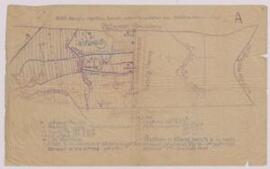
Map of Louvignies-Quesnoy, Northern France (near the Belgian border),
Part of Papers of Major W.P. Wheldon,
Indicates: British Front Line, points of likely resistance, lines of rifle pits or organised shell holes.
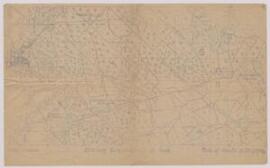
Map of Engelfontaine, France (on fragile tracing paper),
Part of Papers of Major W.P. Wheldon,
Indicates objectives, hazards, inter-battalion boundaries and battalion assembly areas.
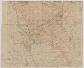
Map of Englefontaine, Northern France,
Part of Papers of Major W.P. Wheldon,
Displays enemy dispositions. Scale – 1:20000.
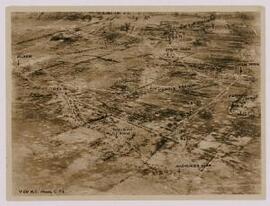
Four Reconnaissance Photographs (Northern France / Belgium),
Part of Papers of Major W.P. Wheldon,
(i.) June 1917, Pilckem area - indicates key features including trenches; (ii.) 21 July 1917, Unknown area (N. France / Belgium?) - shows network of trenches; (iii.) 24 April 1917, Unknown area (N. France / Belgium?) - shows network of trenches, river with makeshift bridges; (iv.) 17 June 1917, Pilckem area - displays key features, including trenches.