- BMSS/39687.
- Ffeil
- n.d.
Rhan oU.C.N.W. (University College of North Wales) Collection of Papers relating to the First World War,
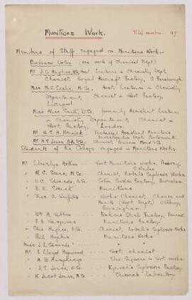
Members of staff and students of the College engaged in Munitions Work.
132 canlyniad gyda gwrthrychau digidol Dangos canlyniadau gyda gwrthrychau digidol
Rhan oU.C.N.W. (University College of North Wales) Collection of Papers relating to the First World War,
Members of staff and students of the College engaged in Munitions Work.
Rhan oU.C.N.W. (University College of North Wales) Collection of Papers relating to the First World War,
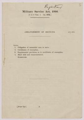
Obligation of unmarried men to serve; Certificates of Exemption; supplemental provisions as to certificates of exemption; short-title and commencement.
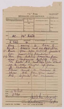
Requests position details and current situation.
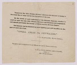
Message from C.G. Blackader, Major General,
Message from C.G. Blackader, Major General, to be distributed to all Officers and read by them to their men, written the day before the 38th (Welsh) Division took Pilckem and Langemark, providing words of encouragement to boost morale.
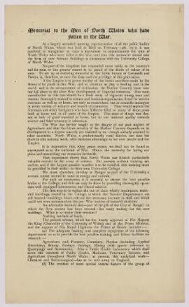
"Memorial to the men of North Wales who have fallen in the War",
Rhan oU.C.N.W. (University College of North Wales) Collection of Papers relating to the First World War,
Report from a meeting held at Rhyl to inaugurate a movement to commemorate the men of North Wales who had fallen in the War.
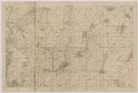
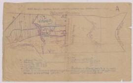
Map of South East of Cambrai, Northern France,
‘Enemy Organisation 21.9.18.’ With references.
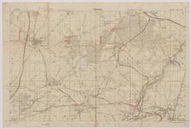
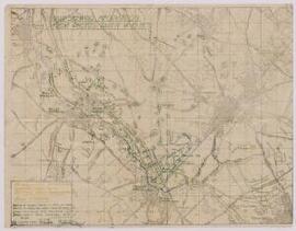
Map of South East of Cambrai, Northern France (Bohain area),
Indicates enemy trenches and organisation. Scale – 1:20000.
Map of Pilkem / Boezinge area of Belgium,
Indicates locations of trenches, inter-divisional boundaries, and inter-brigade boundaries.
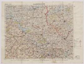
Map of Northern France, Hazebrouck (near to the Belgian border),
Scale – 1:100000.
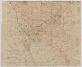
Map of Louvignies-Quesnoy, Northern France (near the Belgian border),
Indicates: British Front Line, points of likely resistance, lines of rifle pits or organised shell holes.
Map of Le Quesnoy, Northern France (near to the Belgian border),
From the Field Survey Battalion. Scale – 1:40000.
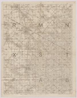
Map of Englefontaine, Northern France,
Displays enemy dispositions. Scale – 1:20000.
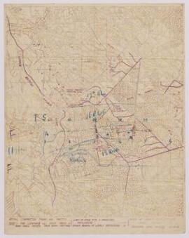
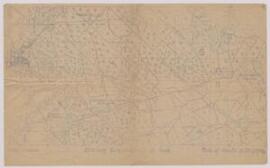
Map of Engelfontaine, France (on fragile tracing paper),
Indicates objectives, hazards, inter-battalion boundaries and battalion assembly areas.
Map : ‘Reproduction of captured German Map with British grid superimposed.’ Northern France,
Indicates locations of trenches, dugout shafts, centres of machine gun resistance, wire, organised shell holes and rifle pits, damaged areas. Scale - 1:20000.
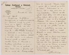
Llythyr oddi wrth Y Parch J.J. Williams, Treforis, at Silyn,
Rhan oR. Silyn Roberts Papers,
Englynion o waith J.R. Jones, Trawsfynydd, i'w cynnwys yn Cerddi'r Bugail.