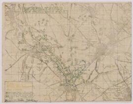
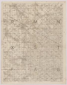
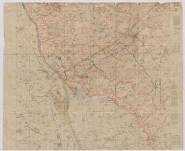
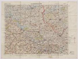
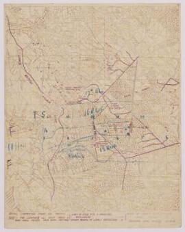
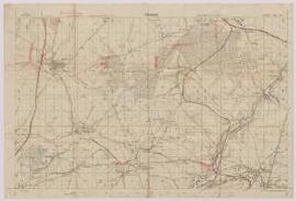
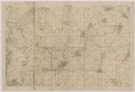
Map : ‘Reproduction of captured German Map with British grid superimposed.’ Northern France,
- BMSS/39624.
- File
- 1918, Oct. 14.
Part of Papers of Major W.P. Wheldon,
Indicates locations of trenches, dugout shafts, centres of machine gun resistance, wire, organised shell holes and rifle pits, damaged areas. Scale - 1:20000.
![Photograph of Major Wheldon with 3 other men in uniform [officers?], France,](/uploads/r/bangor-university-archives-and-special-collections/6/8/0/68002306675bf41400030142ae0acc79fb62d802088f4fd5d91388af43245a3f/default_142.jpg)
![Photograph of Major Wheldon with 3 other men in uniform [officers?], in a field cemetery, France,](/uploads/r/bangor-university-archives-and-special-collections/1/e/c/1ec76d30896cdfd34f369c2d70e0a38dd502522220abb2d52515b7663cd85687/default_142.jpg)